National Agriculture Imagery Program (NAIP)
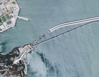
NAIP imagery includes 1-meter resolution aerial based photos of the entire state of California. It was flown for California in 2005 and more recently in 2009 through a multi-agency effort.
Data is hosted through Cal-Atlas, and can be downloaded from their site here.
Current offerings include:
2009 - Combined Natural Color/Infrared (4-Band)
Available as Digital Orthophoto Quarter-Quadrangle (DOQQ) in GeoTIF format. These images. An index shapefile to identify the location of each image can be downloaded here (ZIP - 727KB).
2009 - Natural Color
Available as County wide photo mosaics in the MrSid format, download the ".sid" and ".sdw" files to view the imagery in a GIS.
2005 - Natural Color
Available as County wide photo mosaics in the MrSid format, as Digital Orthophoto Quadrangle (DOQ) in JPEG2000 format, or in Digital Orthophoto Quarter-Quadrangle (DOQQ) in GeoTIF format.
2005 - Color Infrared
Available as Digital Orthophoto Quadrangle (DOQ) in JPEG2000 format.
