WESTCARB Carbon Atlas
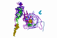
The WESTCARB Carbon Atlas provides the locations of major industrial CO2 emissions sources, areas with geologic formations capable of storing CO2, boundaries of publicly owned lands relevant to geologic and terrestrial sequestration opportunity characterization, and features such as transportation arteries, rivers and streams, and jurisdictional boundaries.
Home > Data Access
These data layers have been exported from the WESTCARB partnership database. They are available in downloadable GIS vector formats as well as ArcGIS Services.
Vector Downloads
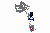
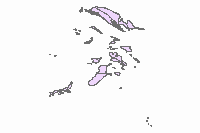
Potential Geologic CO2 Sinks
| AK Coal Basins | Shapefile | 82k | |
| AK Oil and Gas Fields | Shapefile | 586k | |
| AK Sedimentary Basins | Shapefile | 636k | |
| AZ Sedimentary Basins | Shapefile | 6k | |
| B.C. Coal Fields | Shapefile | 45k | |
| B.C. Sedimentary Basins | Shapefile | 265k | |
| B.C. Oil and Gas Fields | Shapefile | 265k | |
| CA Oil and Gas Fields | Shapefile | 448k | |
| CA Sedimentary Basins | Shapefile | 448k | |
| NV Sedimentary Basins | Shapefile | 187k | |
| OR/WA Consolidated Basins | Shapefile | 34k | |
| Lower 48 Coal Fields | Shapefile | 88k |
CO2 Point Sources
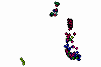
| WESTCARB Carbon Sources - updated: 2012-09-05 | Shapefile | 52k | |
| WESTCARB Carbon Sources - updated: 2012-09-05 | Excel table | 8k |
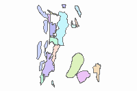
Terrestrial Data
| California Terrestrial Data | 9.3 Geodatabase | 69.5Mb | |
| Oregon Terrestrial Data | 9.3 Geodatabase | 287.6Mb | |
| Washington Terrestrial Data | 9.3 Geodatabase | 367.3Mb |
ArcGIS Services
Carbon Sources
Visit this layer's page on ArcGIS.com
Open in ArcGIS.com Map Viewer
Open this layer in ArcGIS Explorer Online
Open this layer in ArcGIS Desktop via lyr file
Open this layer in Google Earth via kmz file
Sedimentary Basins
Visit this layer's page on ArcGIS.com
Open in ArcGIS.com Map Viewer
Open this layer in ArcGIS Explorer Online
Open this layer in ArcGIS Desktop via lyr file
Open this layer in Google Earth via kmz file
Oregon Washington Consolidated Basins
Visit this layer's page on ArcGIS.com
Open in ArcGIS.com Map Viewer
Open this layer in ArcGIS Explorer Online
Open this layer in ArcGIS Desktop via lyr file
Open this layer in Google Earth via kmz file
Alaska Coal Fields
Visit this layer's page on ArcGIS.com
Open in ArcGIS.com Map Viewer
Open this layer in ArcGIS Explorer Online
Open this layer in ArcGIS Desktop via lyr file
Open this layer in Google Earth via kmz file
Oregon Washington Isopach
Visit this layer's page on ArcGIS.com
Open in ArcGIS.com Map Viewer
Open this layer in ArcGIS Explorer Online
Open this layer in ArcGIS Desktop via lyr file
Open this layer in Google Earth via kmz file
California Isopach
Visit this layer's page on ArcGIS.com
Open in ArcGIS.com Map Viewer
Open this layer in ArcGIS Explorer Online
Open this layer in ArcGIS Desktop via lyr file
Open this layer in Google Earth via kmz file
Oil and Gas
Visit this layer's page on ArcGIS.com
Open in ArcGIS.com Map Viewer
Open this layer in ArcGIS Explorer Online
Open this layer in ArcGIS Desktop via lyr file
Open this layer in Google Earth via kmz file